


-
[Name]: Dornoch Firth and Loch Fleet
[Council area]: Highland
[Designated]: 1997-03-24
[Area (hectares)]: 7,837
[Coordinates]: 57°51′0″N 4°2′0″W / 57.85000°N 4.03333°W / 57.85000; -4.03333 (Dornoch Firth andLoch Fleet)
[Site code]: UK13011
[Image]: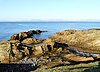
(List of Ramsar sites in Scotland) -
[Name]: Sléibhtean agus Cladach Thiriodh (Tiree Wetlands and Coast)
[Council area]: Argyll and Bute
[Designated]: 2001-11-16
[Area (hectares)]: 1,939
[Coordinates]: 56°30′0″N 6°52′0″W / 56.50000°N 6.86667°W / 56.50000; -6.86667 (Sléibhtean agus Cladach Thiriodh)
[Site code]: UK13056
[Image]:
(List of Ramsar sites in Scotland) -
[Name]: Coll
[Council area]: Argyll and Bute
[Designated]: 1995-03-31
[Area (hectares)]: 2,209
[Coordinates]: 56°39′0″N 6°30′0″W / 56.65000°N 6.50000°W / 56.65000; -6.50000 (Coll)
[Site code]: UK13008
[Image]:
(List of Ramsar sites in Scotland) -
[Name]: Rannoch Moor
[Council area]: Perth and Kinross
[Designated]: 1976-01-05
[Area (hectares)]: 1,519
[Coordinates]: 56°39′0″N 4°36′0″W / 56.65000°N 4.60000°W / 56.65000; -4.60000 (Rannoch Moor)
[Site code]: UK13051
[Image]:
(List of Ramsar sites in Scotland) -
[Name]: Eilean na Muice Duibhe (Duich Moss), Islay
[Council area]: Argyll and Bute
[Designated]: 1988-07-14
[Area (hectares)]: 576
[Coordinates]: 55°43′0″N 6°15′0″W / 55.71667°N 6.25000°W / 55.71667; -6.25000 (Eilean na Muice Duibhe)
[Site code]: UK13014
[Image]:
(List of Ramsar sites in Scotland) -
[Name]: Gladhouse Reservoir
[Council area]: Midlothian
[Designated]: 1988-07-14
[Area (hectares)]: 186
[Coordinates]: 55°47′0″N 3°6′0″W / 55.78333°N 3.10000°W / 55.78333; -3.10000 (Gladhouse Reservoir)
[Site code]: UK13021
[Image]: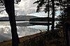
(List of Ramsar sites in Scotland)
New Random Display Display All Items(51)